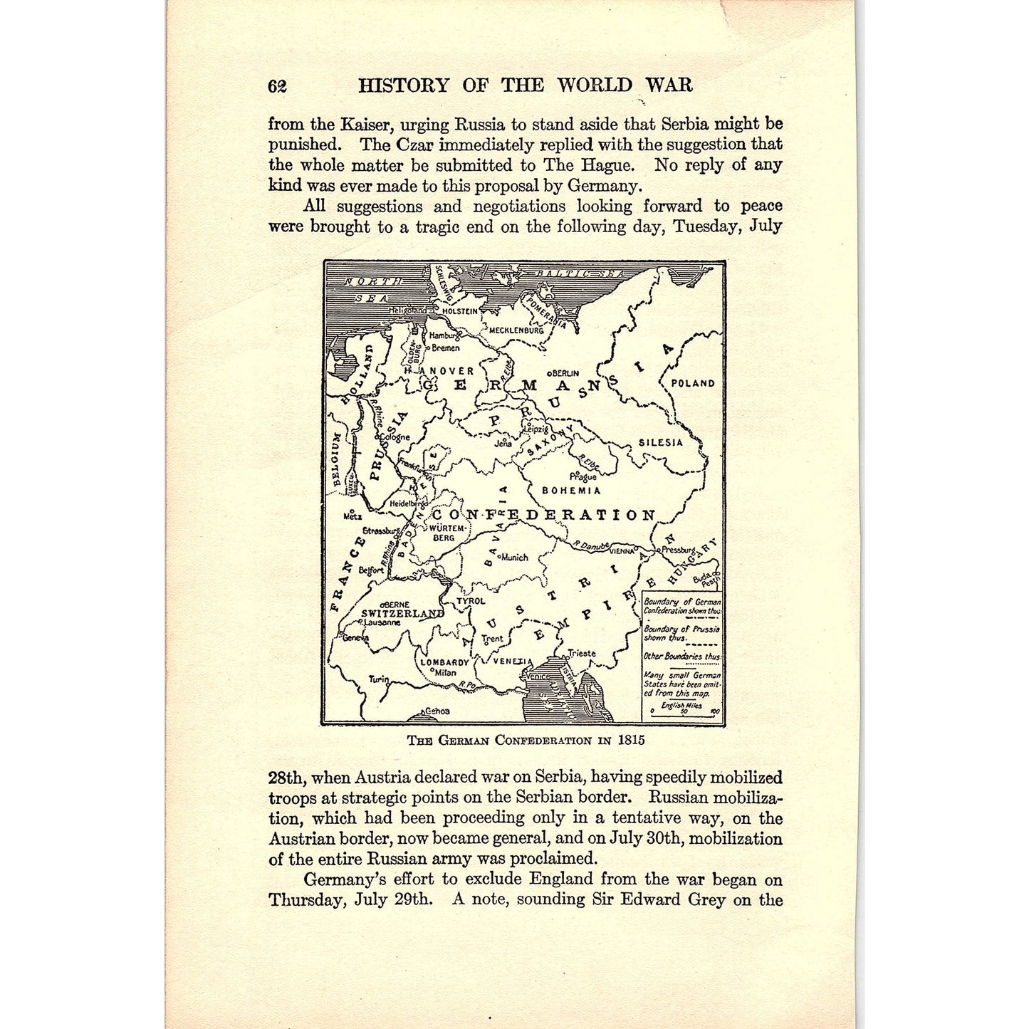


Map of the German Confederation in 1815 - 1919 WWI Map Print AF9-14
Map of the German Confederation in 1815 - 1919 WWI Map Print AF9-14
Regular price
$27.00 USD
Regular price
Sale price
$27.00 USD
Unit price
per
Tax included.
Couldn't load pickup availability
Measures approximately 6x9". Original piece pulled from 1919 Book - The History of the World, an Authentic Narrative of the World's Greatest War. See pics for condition.
Map of the German Confederation in 1815 - 1919 WWI Map Print AF9-14
Map of the German Confederation in 1815 - 1919 WWI Map Print AF9-14