


1977 Fort Sumter National Monument Walking Tour Leaflet & Fold Out Map TG6
1977 Fort Sumter National Monument Walking Tour Leaflet & Fold Out Map TG6
Regular price
$12.00 USD
Regular price
Sale price
$12.00 USD
Unit price
per
Tax included.
Couldn't load pickup availability
See pics for condition.
1977 Fort Sumter National Monument Walking Tour Leaflet & Fold Out Map TG6
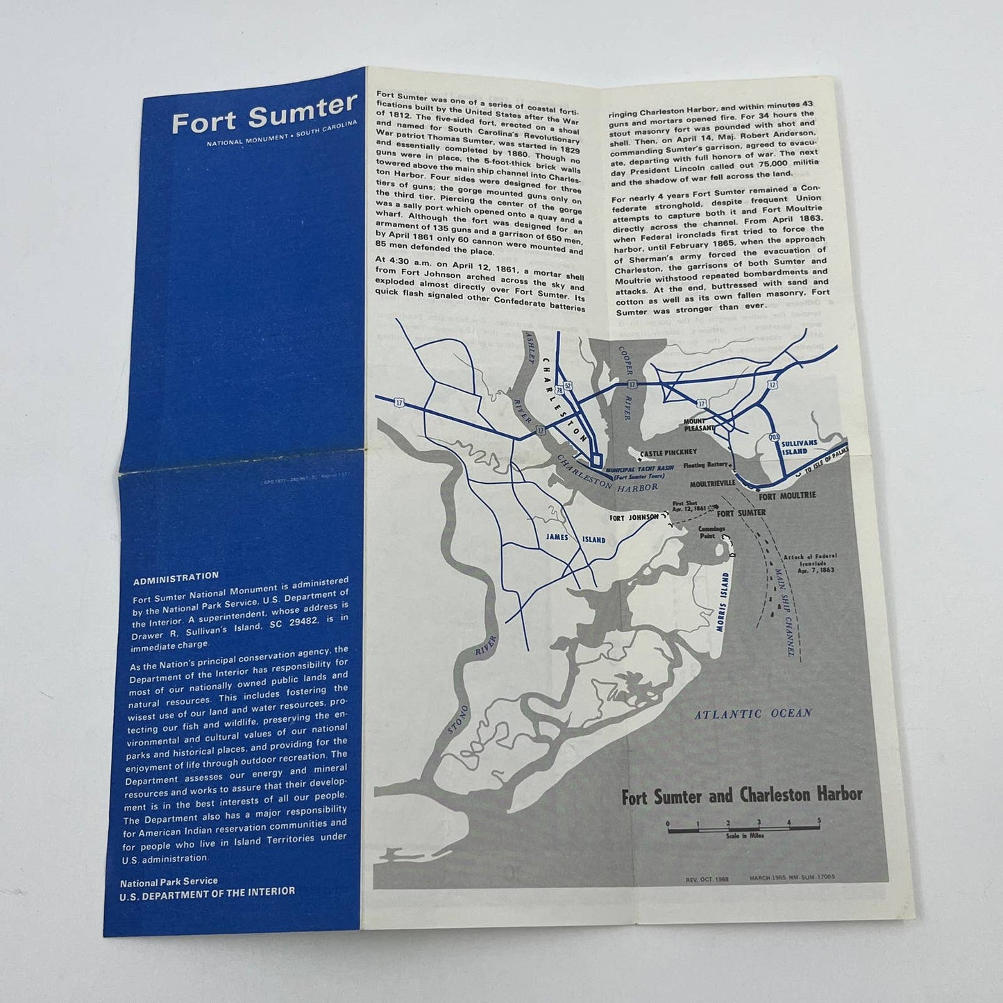
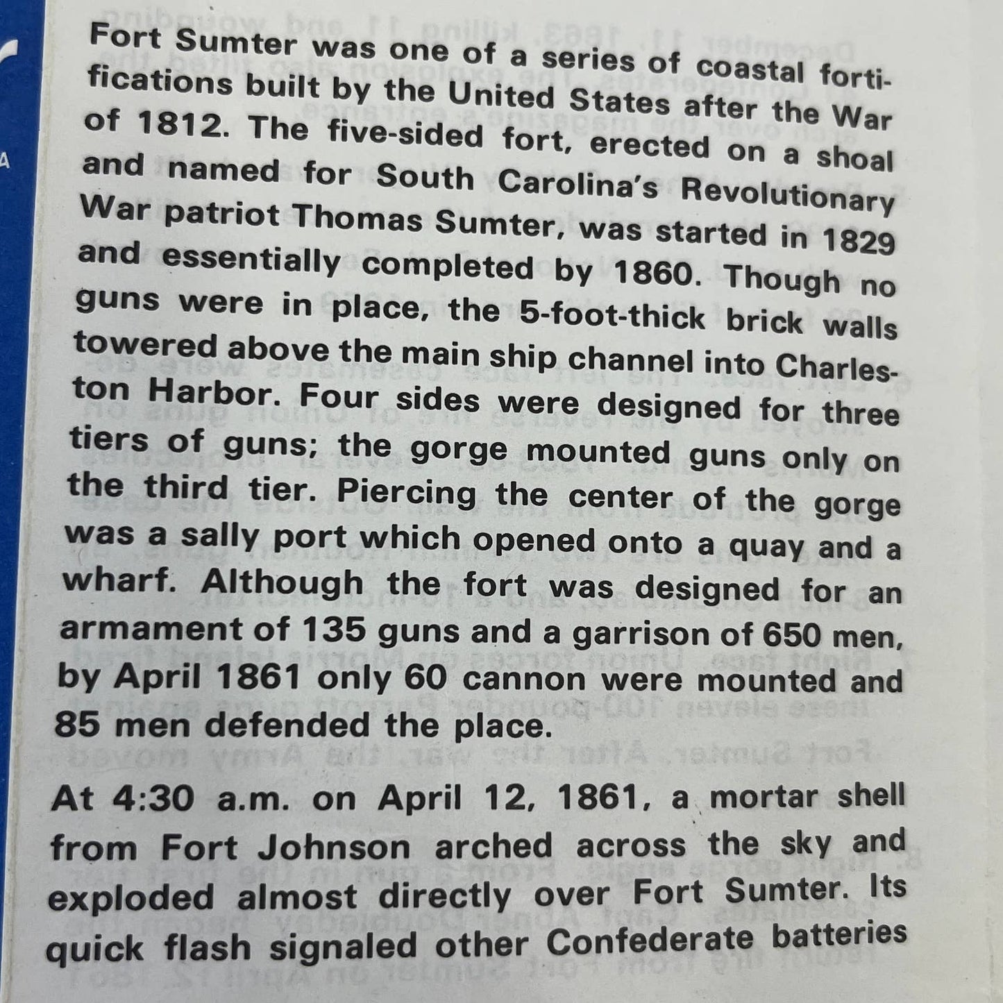
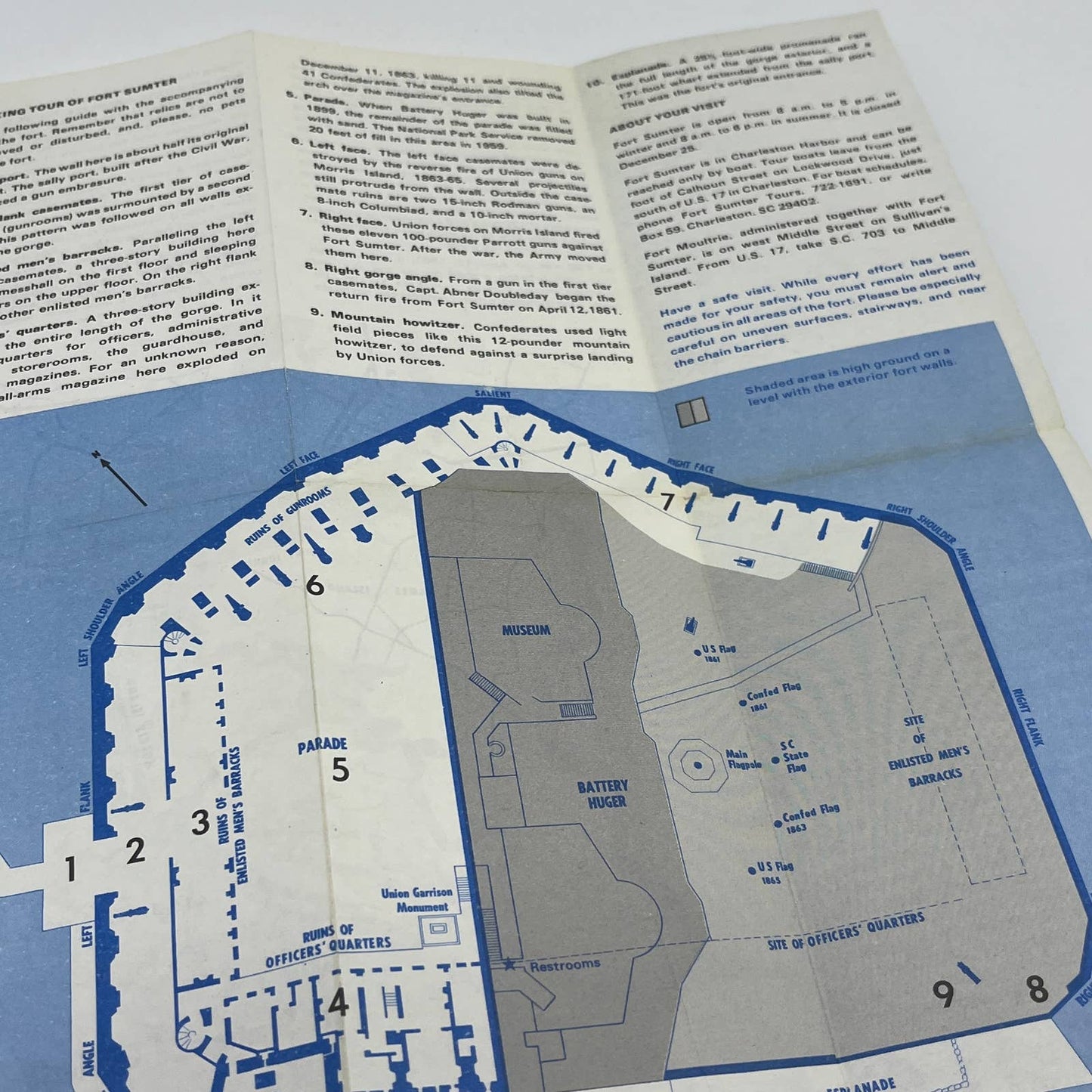
Fort Sumter was one of a series of coastal fortifications built by the United States after the War of 1812. The five-sided fort, erected on a shoal and named for South Carolina's Revolutionary War patriot Thomas Sumter, was started in 1829 and essentially completed by 1860. Though no guns were in place, the 5-foot-thick brick walls towered above the main ship channel into Charleston Harbor. Four sides were designed for three tiers of guns; the gorge mounted guns only on the third tier. Piercing the center of the gorge was a sally port which opened onto a quay and a wharf. Although the fort was designed for an armament of 135 guns and a garrison of 650 men, by April 1861 only 60 cannon were mounted and 85 men defended the place.
At 4:30 a.m. on April 12, 1861, a mortar shell from Fort Johnson arched across the sky and exploded almost directly over Fort Sumter.
1977 Fort Sumter National Monument Walking Tour Leaflet & Fold Out Map TG6
Fort Sumter was one of a series of coastal fortifications built by the United States after the War of 1812. The five-sided fort, erected on a shoal and named for South Carolina's Revolutionary War patriot Thomas Sumter, was started in 1829 and essentially completed by 1860. Though no guns were in place, the 5-foot-thick brick walls towered above the main ship channel into Charleston Harbor. Four sides were designed for three tiers of guns; the gorge mounted guns only on the third tier. Piercing the center of the gorge was a sally port which opened onto a quay and a wharf. Although the fort was designed for an armament of 135 guns and a garrison of 650 men, by April 1861 only 60 cannon were mounted and 85 men defended the place.
At 4:30 a.m. on April 12, 1861, a mortar shell from Fort Johnson arched across the sky and exploded almost directly over Fort Sumter.