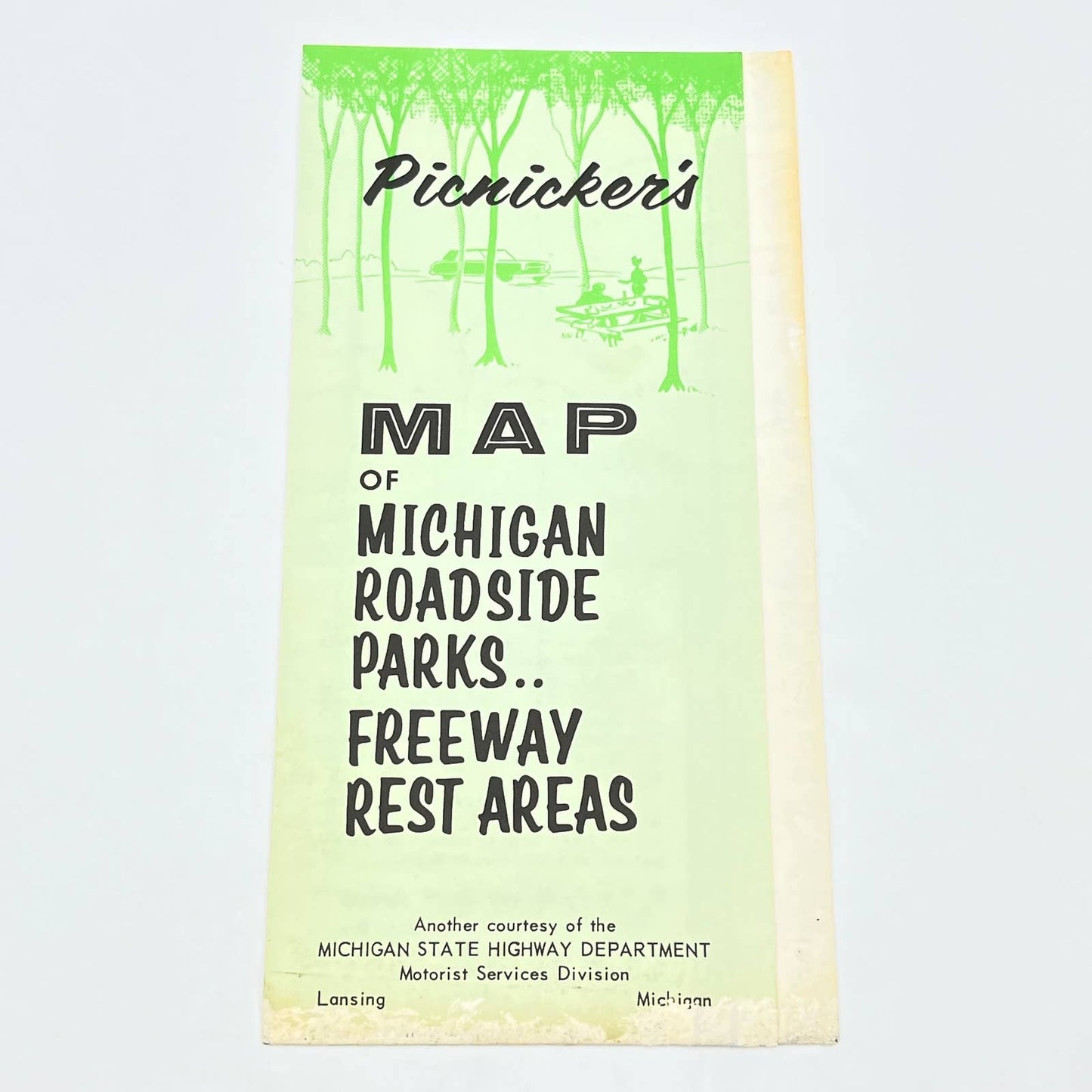


1960s Picnicker's Map of Michigan Roadside Parks & Freeway Rest Areas AC1
1960s Picnicker's Map of Michigan Roadside Parks & Freeway Rest Areas AC1
Regular price
$17.00 USD
Regular price
Sale price
$17.00 USD
Unit price
per
Tax included.
Couldn't load pickup availability
See Pics for condition.
1960s Picnicker's Map of Michigan Roadside Parks & Freeway Rest Areas AC1
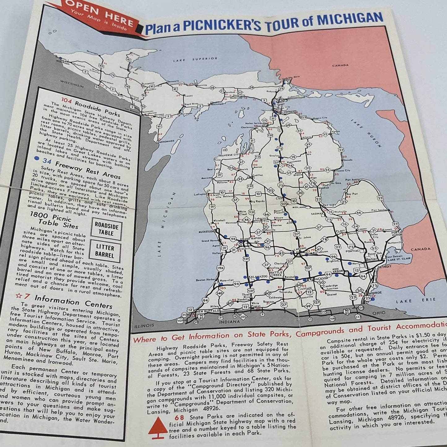
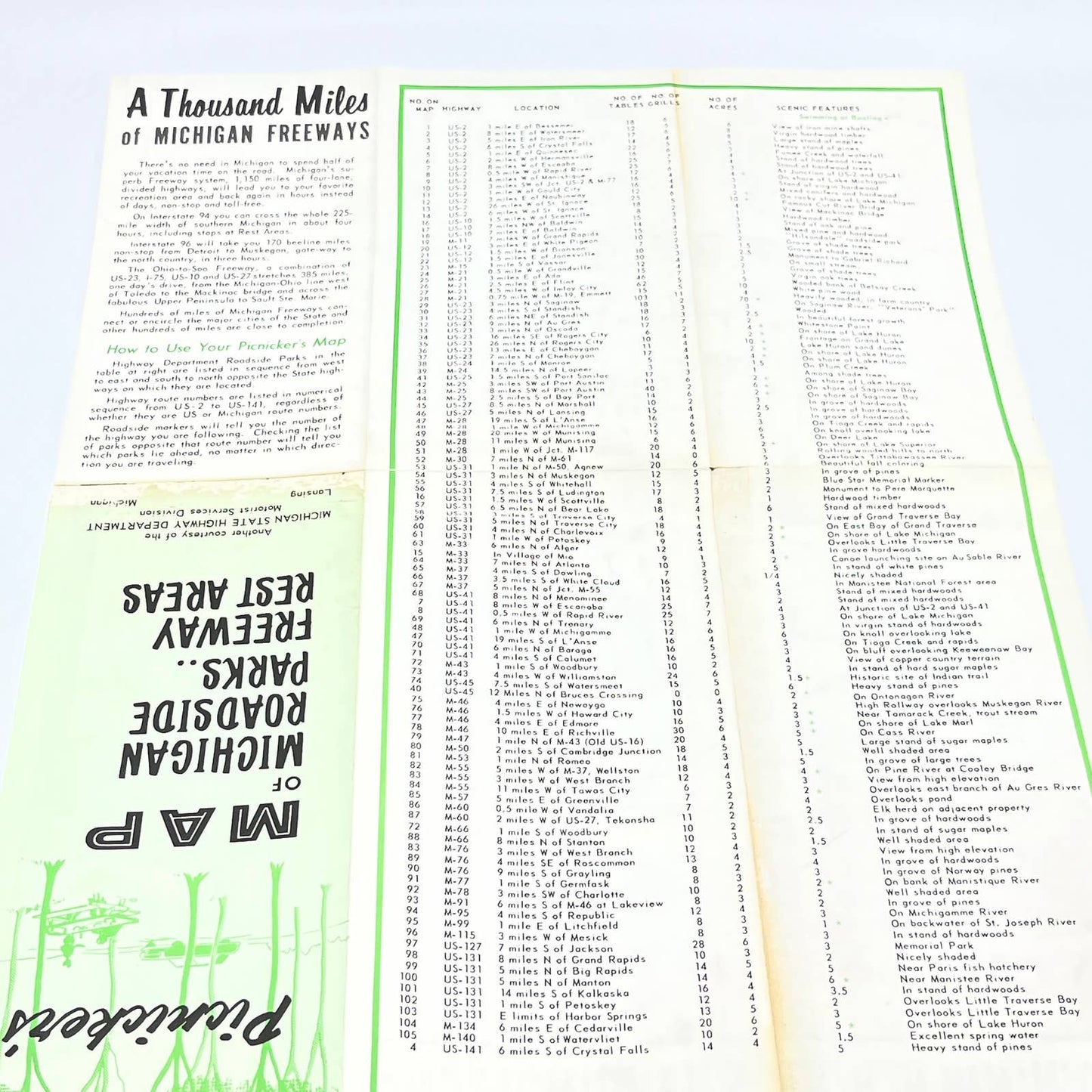
There's no need in Michigan to spend half of your vacation time on the road. Michigan's superb Freeway system, 1,150 miles of four-lane, divided highways, will lead you to your favorite recreation area and back again in hours instead of days, non-stop and toll-free.
On Interstate 94 you can cross the whole 225-mile width of southern Michigan in about four hours, including stops at Rest Areas.
Interstate 96 will take you 170 beeline miles non-stop from Detroit to Muskegon, gate-way to the north country, in three hours.
The Ohio-to-Soo Freeway, a combination of US-23, 1-75, US-10 and US-27 stretches 385 miles, one day's drive, from the Michigan-Ohio line west of Toledo to the Mackinac bridge and across the fabulous Upper Peninsula to Sault Ste. Marie.
Hundreds of miles of Michigan Freeways connect or encircle the major cities of the State.
1960s Picnicker's Map of Michigan Roadside Parks & Freeway Rest Areas AC1
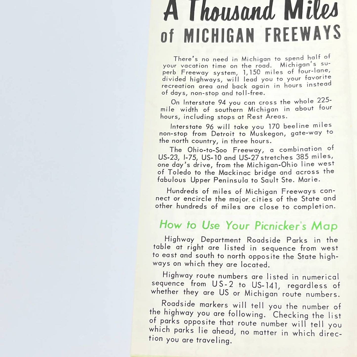
There's no need in Michigan to spend half of your vacation time on the road. Michigan's superb Freeway system, 1,150 miles of four-lane, divided highways, will lead you to your favorite recreation area and back again in hours instead of days, non-stop and toll-free.
On Interstate 94 you can cross the whole 225-mile width of southern Michigan in about four hours, including stops at Rest Areas.
Interstate 96 will take you 170 beeline miles non-stop from Detroit to Muskegon, gate-way to the north country, in three hours.
The Ohio-to-Soo Freeway, a combination of US-23, 1-75, US-10 and US-27 stretches 385 miles, one day's drive, from the Michigan-Ohio line west of Toledo to the Mackinac bridge and across the fabulous Upper Peninsula to Sault Ste. Marie.
Hundreds of miles of Michigan Freeways connect or encircle the major cities of the State.